This dataset provides fixed broadband performance metrics in zoom level 16 web Mercator tiles (approximately 610.8 meters by 610.8 meters at the equator). Download speed is collected via the Speedtest by Ookla applications for Android and iOS and averaged for each tile. Measurements are filtered to results containing GPS-quality location accuracy. Speedtest data is used today by commercial fixed network operators around the world to inform network buildout, improve global Internet quality, and increase Internet accessibility. This data can be used for rural and urban connectivity development, to help make the internet better, faster, and more accessible for everyone.
This dataset provides fixed broadband performance metrics in zoom level 16 web Mercator tiles (approximately 610.8 meters by 610.8 meters at the equator). Download speed is collected via the Speedtest by Ookla applications for Android and iOS and averaged for each tile. Measurements are filtered to results containing GPS-quality location accuracy. Speedtest data is used today by commercial fixed network operators around the world to inform network buildout, improve global Internet quality, and increase Internet accessibility. This data can be used for rural and urban connectivity development, to help make the internet better, faster, and more accessible for everyone.
This dataset provides mobile (cellular) network performance metrics in zoom level 16 web Mercator tiles (approximately 610.8 meters by 610.8 meters at the equator). Download speed is collected via the Speedtest by Ookla applications for Android and iOS and averaged for each tile. Measurements are filtered to results containing GPS-quality location accuracy. Speedtest data is used today by commercial mobile network operators around the world to inform network buildout, improve global Internet quality, and increase Internet accessibility. This data can be used for rural and urban connectivity development, to help make the internet better, faster, and more accessible for everyone.
This dataset provides mobile (cellular) network performance metrics in zoom level 16 web Mercator tiles (approximately 610.8 meters by 610.8 meters at the equator). Download speed is collected via the Speedtest by Ookla applications for Android and iOS and averaged for each tile. Measurements are filtered to results containing GPS-quality location accuracy. Speedtest data is used today by commercial mobile network operators around the world to inform network buildout, improve global Internet quality, and increase Internet accessibility. This data can be used for rural and urban connectivity development, to help make the internet better, faster, and more accessible for everyone.
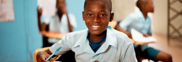
Percentage of children in a school attendance age (approximately 3-17 years old depending on the country) that have internet connection at home. Also in this case the indicator relates to the potential educational impact of electrification on children and young people.
This dataset comprises a collection of shapefiles detailing the geographical locations and attributes of various wells across Africa, with a strong focus on geothermal exploration and assessment. Together, these layers offer a valuable resource for geothermal energy planning, subsurface geological analysis, and infrastructure mapping. The collection includes the following spatial data layers:
Wells: Maps the locations of various existing well types and provides critical geothermal metrics where available, including well names, temperature correction states, thermal gradients, heat flow, and heat production data.
BGS Well: A compiled spatial layer derived from scientific literature that categorizes well locations and types.
Planned wells: Highlights the prospective locations of future geothermal wells across the continent.
The INFORM Risk Index 2021 is a composite model structured into a hierarchy of dimensions, categories, and components. All scores are normalized on a scale of 0 to 10 (10 being the highest risk).
Below is the clear breakdown of the index's architecture based on your descriptions:
The Composite Index
The top-level score representing a country's overall risk of humanitarian crisis. It is used to assign countries into Risk Classes:
Low: ≤3.5
Medium: 3.5−5.0
High: 5.0−6.5
Very High: ≥6.5
Dimension: Vulnerability
This dimension measures the predisposition of a population to be affected by a hazard based on economic, political, and social characteristics.
Sub-Index: Socio-Economic Vulnerability
An aggregate index covering three main components of systemic instability:
Development Deprivation: Measures poverty using the Human Development Index (HDI) and Multidimensional Poverty Index (MPI).
Inequality: Captures the dispersion of human development, including the Gender Inequality Index and the Gini Coefficient.
Aid Dependency: Measures economic instability through reliance on public aid, development assistance, and remittances.
Sub-Index: Vulnerable Groups
Captures social groups with limited access to care and heightened susceptibility:
Uprooted People: Tracks refugees, IDPs, and returnees.
Children Under 5: Specifically monitors child malnutrition and mortality rates.
Recent Shocks: Factors in populations already affected by natural disasters in the last 3 years.
Food Security: Captures trends in chronic hunger and nutritional balance.
Health Conditions: Monitors the prevalence of pandemics (HIV, TB, Malaria) and neglected tropical diseases.
Dimension: Lack of Coping Capacity
This dimension measures the ability of a country to manage and recover from disasters through its infrastructure and government effort.
Sub-Index: Institutional Capacity
Measures the "soft" infrastructure of a country's disaster management:
Governance: Captures government effectiveness, resilience-building, and political integrity (lack of corruption).
DRR Implementation: Quantifies how well Disaster Risk Reduction activities are actually put into practice.
Sub-Index: Infrastructure
Measures the "hard" assets and systems available during a crisis:
Communication: Evaluates the efficiency of early warning dissemination and the literacy/education of the recipients.
Physical Connectivity: Assesses the accessibility of transport and the quality/availability of water and sanitation services.
Access to Healthcare: Captures health system strength, including physician density and maternal/infant health services.