Debug: Image path is empty. in Drupal\twig_tweak\TwigTweakExtension::imageStyleFilter() (line 500 of modules/contrib/twig_tweak/src/TwigTweakExtension.php).
Environmentally sustainable and climate resilient economies and communities
Under the Agenda aspiration 1 - A Prosperous Africa, based on Inclusive Growth and Sustainable Development - the Goal 7 sets the following priority areas: Sustainable natural resource management and Biodiversity conservation; Sustainable consumption and production patterns; Water security; Climate resilience and natural disasters preparedness and prevention; Renewable energy
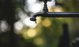
Access to piped water reflects the availability of improved water sources directly delivered to households. This layer shows the percentage of people with access to piped water in 2017. Low coverage m...
This layer shows the percentage of people with access to any improved sanitation facility, including both piped systems (such as sewer or septic tanks) and non-piped improved options (like ventilated ...
This layer provides the Effective Leaf Area Index (LAIe), a critical parameter for modeling evapotranspiration and carbon fluxes between the biosphere and the atmosphere. Monitoring the dis...
This layer presents the Effective Leaf Area Index (LAIe) Anomalies, representing the deviation of current vegetation density from the historical average. Monitoring the change of LAI i...
The Fraction of Photosynthetically Active Radiation Absorbed (FAPAR) is used to track the overall primary productivity associated with atmospheric CO2 fixation. FAPAR anomalies relative to the average...
The Fraction of Absorbed Photosynthetically Active Radiation (FAPAR) is an Essential Climate Variable that serves as an integrated indicator of the status and health of plant canopies. FAPAR plays a c...
Levelized Cost of Energy (LCOE) for PV systems in Africa and the Middle East. The calculations are based on estimates of the PV energy productivity from satellite data combined with models for the per...
HydroBASINS is a global, vectorized layer of hierarchically nested sub-basin boundaries. It provides seamless coverage and uses the 'Pfafstetter' coding system offering a 12 scales breakdown to enable...
HydroRIVERS represents a vectorized line network of all global rivers that have a catchment area of at least 10 km² or an average river flow of at least 0.1 m³/sec, or both. HydroRIVERS only includes ...
The Africa Topographic Potisiont layer classifies the African landscape (including Madagascar, Comoros Islands, and other coastal Islands near continenal Africa) into uplands and lowlands/depressions ...
The dataset depicts the total energy demand per settlement (kWh/day) at year 5 under scenario with household consumption raised to 1000 Wh/day (at year 0). This dataset is part of the e Refugee Settle...