Skip to main content
EU Science Hub
Africa Knowledge Platform
Main navigation
Home
Datasets
Tools
Stories
Partners
Countries
Tutorials
ArcX
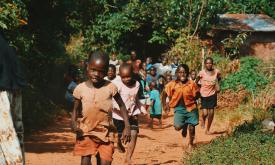
Walking travel time to nearest school (in hours)
Walking travel time to nearest school (in hours)
Dataset
This layer represents the estimated travel time (in hours) by foot to the nearest primary school. The accessibility map is generated using a well-established geospatial methodology that integrates roa...
Related Policies
Agenda 2063 Goal 1
,
SDG Goal 4
,
SDG Goal 11
Related Topics
Education
Socio-economic
Trade, Connectivity and Infrastructures
Select for mapping
Read more
Main navigation
User account menu
Language
Main navigation
Home
Datasets
Tools
Stories
Partners
Countries
Tutorials
ArcX
User account menu
Language
en