Skip to main content
EU Science Hub
Africa Knowledge Platform
Main navigation
Home
Datasets
Tools
Stories
Partners
Countries
Tutorials
ArcX
Trade, Connectivity and Infrastructures
Displaying 1 - 2 of 2
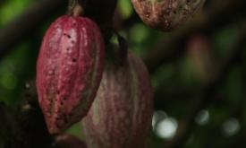
Life Cycle Thinking for our food
Story
Exploring the environmental impacts of food consumption with the example of African cocoa.
Related Policies
SDG 12
,
SDG 14
,
SDG 15
Related Topics
Natural Resources
,
Species
,
Protected and Conserved Areas & Conservation Actions
,
Trade, Connectivity and Infrastructures
,
Food and Agriculture
,
Agricultural production
,
Climate Change And Human Pressure
,
Deforestation
,
Circular Economy
View Story
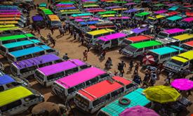
Sustainable African Cities
Story
Urban growth and regional connectivity across a youthful continent
Related Policies
SDG 11
,
SDG 9
Related Topics
Socio-Economic Development
,
Trade, Connectivity and Infrastructures
,
Territorial Development
,
Human Settlements
View Story
Subscribe to Trade, Connectivity and Infrastructures
Main navigation
User account menu
Language
Main navigation
Home
Datasets
Tools
Stories
Partners
Countries
Tutorials
ArcX
User account menu
Language
en