News

News
This dataset provides fixed broadband performance metrics in zoom level 16 web Mercator tiles (approximately 610.8 meters by 610.8 meters at the equator). Download speed is collected via the Speedtest by Ookla applications for Android and iOS and averaged for each tile. Measurements are filtered to results containing GPS-quality location accuracy. Speedtest data is used today by commercial fixed network operators around the world to inform network buildout, improve global Internet quality, and increase Internet accessibility. This data can be used for rural and urban connectivity development, to help make the internet better, faster, and more accessible for everyone.
This dataset provides mobile (cellular) network performance metrics in zoom level 16 web Mercator tiles (approximately 610.8 meters by 610.8 meters at the equator). Download speed is collected via the Speedtest by Ookla applications for Android and iOS and averaged for each tile. Measurements are filtered to results containing GPS-quality location accuracy. Speedtest data is used today by commercial mobile network operators around the world to inform network buildout, improve global Internet quality, and increase Internet accessibility. This data can be used for rural and urban connectivity development, to help make the internet better, faster, and more accessible for everyone.
What's New
The CO2 fixed by photosynthesis is one of the most important components of the carbon cycle. Forests play a key role in this process. They represent large and persistent carbon sinks. Tree carbon stocks are important to quantify terrestrial carbon storage and carbon sinks, and to estimate potential emissions from land cover changes (deforestation, reforestation, afforestation) and from biotic (pests, diseases) and abiotic (forest fires, windstorms) disturbances. Spatially explicit data and assessments of forest biomass and carbon are thus paramount to design and implement effective sustainable forest management options and forest related policies. The above-ground carbon index presented in this dataset is expressed in Mg (megagrams or tonnes) of carbon per km2 . It corresponds to the carbon fraction of the oven-dry weight of the woody parts (stem, bark, branches and twigs) of all living trees, excluding stump and roots, as estimated by the GlobBiomass project (globbiomass.org) with 2010 as the reference year.
Priority areas are identified using local coefficients estimated through Geographically Weighted Regression (GWR), which measures the spatially varying relationship between access to electricity and four nutrition indicators among children under five: stunting, wasting, severe wasting, and underweight.The tool highlights locations where the local association between electricity access and the selected nutrition indicator is both negative and statistically significant. In this application, priority areas are further restricted to locations where electricity access is below 80%, ensuring that the results remain relevant for policy intervention.The identified areas are classified as having strong, moderate, or mild associations according to the magnitude of the local GWR coefficient. This classification helps users determine the appropriate intensity of intervention. The spatially varying coefficients therefore allow users to identify areas where limited electricity access is most strongly associated with poorer nutritional outcomes among children under five, supporting targeted interventions, programme planning, and place-based development strategies.

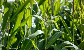
number of crop types (Crop richness)
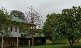
Primary and secondary schools across Africa with water, energy and food needs and costs.