This layer presents the Effective Leaf Area Index (LAIe) Anomalies, representing the deviation of current vegetation density from the historical average. Monitoring the change of LAI i...
The Fraction of Photosynthetically Active Radiation Absorbed (FAPAR) is used to track the overall primary productivity associated with atmospheric CO2 fixation. FAPAR anomalies relative to the average...
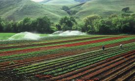
Crop conditions monitoring is highly relevant for food security early warning and response planning in food insecure areas of the world. GEOGLAM is the Group on Earth Observations' Global Agricultural...
Crop conditions monitoring is highly relevant for food security early warning and response planning in food insecure areas of the world. GEOGLAM is the Group on Earth Observations' Global Agricultural...
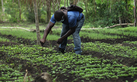
Humans need increasingly more biomass for food, fodder, fiber and energy. In Africa, circa 22% of the vegetated land surface showed a decline or unstable land productivity between 1999 and 2013. Persi...
The IPC Mapping Tool is an enhanced interactive interface that shows a map of all the countries the IPC works in and allows you to download population data.