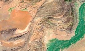
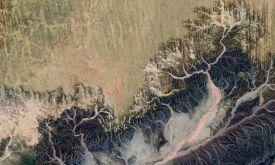
Water is a critical natural resource for both natural ecosystems and human subsistence. Some of the most immediate pressures on land that lead to degradation include diversion of surface waters and th...
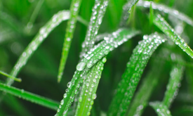
Changes in vegetation biomass are critical in assessing land degradation. Climate variations, alone or in combination with human-induced land use and land change, can affect biomass productivity and m...
Forests are the most biologically diverse land ecosystems and are critical for sustaining local and global livelihoods. Deforestation can be considered a type of land degradation when forest ecosystem...
Poverty affects billions of people around the globe. On a daily basis, they face low wages and substandard health, education, and living standards. Because of this, poverty must be understood and appr...
Poverty affects billions of people around the globe. On a daily basis, they face low wages and substandard health, education, and living standards. Because of this, poverty must be understood and appr...
The Africa Topographic Moisture Potential layer classifies the landscape of Africa as either upland or lowland (and other depressions) area. It was produced as part of the USGS’s Africa Ecosystems Map...
The Africa Surficial Lithology layer maps the geology of Africa into 20 classes based on the bedrock type and the distribution of unconsolidated surface material. It shows the distribution of the key ...
Organisms and non-living elements of the environment such as climate, soil, and water are connected through the movement of nutrients and energy in ecosystems. Ecosystems represent specific areas wher...
Smallholder farmers and pastoralists have restricted access to capital and may not have the capacity to invest in management practices that mitigate land degradation. This layer displays the areas of ...
The application of fertiliser is a key component in increasing agricultural production. However, there are thresholds beyond which the cost of inputs fails to lead to corresponding increases in yield....
Priority areas are identified using local coefficients estimated through Geographically Weighted Regression (GWR), which measures the spatially varying relationship between access to sanitation and fo...
Priority areas are identified using local coefficients estimated through Geographically Weighted Regression (GWR), which measures the spatially varying relationship between access to electricity and f...
Priority areas are identified using local coefficients estimated through Geographically Weighted Regression (GWR), which measures the spatially varying relationship between access to piped water and f...
This dataset represents a geographic clip to Africa of the
World Database on Protected Areas (WDPA),
which is the authoritative and most complete global dataset on terrestrial and ...
This spatial dataset contains the geographic boundaries and ecological evaluations of 45 Key Landscapes for Conservation and Development (KLCDs) across Sub-Saharan Africa. Building on the K...