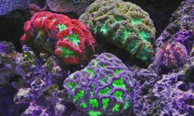
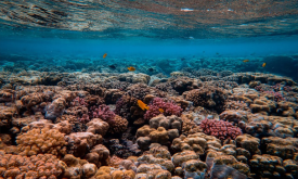
This dataset is an index that estimates the relative value provided by coral reefs that protect coastlines through reduction of wave height and wave energy. The value as of 2014 is modelled as a funct...
The Marine Ecoregions of the World is a global system to classify the oceans, helping to plan and prioritise marine conservation measures. How much are marine areas are protected at ecoregion level? F...
The Fraction of Absorbed Photosynthetically Active Radiation (FAPAR) is an Essential Climate Variable that serves as an integrated indicator of the status and health of plant canopies. FAPAR plays a c...
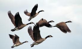
Displays areas where the geographic range of two or more endemic bird species overlaps. While many bird species are widespread, over 2,500 are endemic and restricted to an area smaller than 5 million ...
The Fraction of Photosynthetically Active Radiation Absorbed (FAPAR) is used to track the overall primary productivity associated with atmospheric CO2 fixation. FAPAR anomalies relative to the average...
The United Nations Educational, Scientific and Cultural Organization (UNESCO) seeks to encourage the identification, protection and preservation of natural heritage around the world considered to be o...
This layer presents the Effective Leaf Area Index (LAIe) Anomalies, representing the deviation of current vegetation density from the historical average. Monitoring the change of LAI i...
This layer provides the Effective Leaf Area Index (LAIe), a critical parameter for modeling evapotranspiration and carbon fluxes between the biosphere and the atmosphere. Monitoring the dis...
The Sahel is an area that, over time, has had multiple definitions, climatic-botanical and political: its limits have been traced in very different ways. Even the usage of this name and its delimitati...
The Sahel is an area that, over time, has had multiple definitions, climatic-botanical and political: its limits have been traced in very different ways. Even the usage of this name and its delimitati...
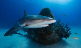
The global capture fisheries has increased over the last 50 years as the consumption of seafood has doubled.This has increased pressure on fish stocks across the world. According to the State of World...
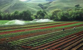
Humans need increasingly more biomass for food, fodder, fiber and energy. In Africa, circa 22% of the vegetated land surface showed a decline or unstable land productivity between 1999 and 2013. Persi...
HydroRIVERS represents a vectorized line network of all global rivers that have a catchment area of at least 10 km² or an average river flow of at least 0.1 m³/sec, or both. HydroRIVERS only includes ...
This map provides a spatially explicit characterization of 47 terrestrial habitat types, as defined in the International Union for Conservation of Nature (IUCN) habitat classification scheme, which is...
This map provides a spatially explicit characterization of 47 terrestrial habitat types, as defined in the International Union for Conservation of Nature (IUCN) habitat classification scheme, which is...