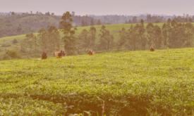
Presenting the eStation, a software deployed in Africa to acquire and process Earth Observation data, and two of its applications for fishing (in Tanzania) and farming (in the Sahel).
...
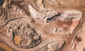
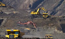
This data set provides spatially explicit estimates of the area directly used for surface mining on a global scale. It contains 44,929 polygon features, covering 101,583 km² of land used by the global...
Mining has major economic, environmental and societal consequences, yet knowledge and understanding of its global footprint are still limited. These polygons represent the global mining land use detec...
The NASA Making Earth System Data Records for Use in Research Environments (MEaSUREs) Shuttle Radar Topography Mission (SRTM) global 1 arc second (~30 metre) DEM is archived and distributed by the Lan...
This dataset provides the hydrological boundaries for major river basins and sub-basins across the African continent. Developed by the FAO Land and Water Division under the AQUASTAT program, the data ...
This dataset shows the global distribution of coral reefs in tropical and
subtropical regions. It is the most comprehensive global dataset of
warm-water coral reefs to date, acting as a foundation b...
This dataset provides projections of global rainfall erosivity changes, a critical metric representing the erosive force of rainfall that drives worldwide soil and nutrient loss. These maps serve as e...
Forests worldwide are in a state of flux, with accelerating losses in some regions and gains in others. Given the recognized importance of forest ecosystem services, quantification of global forest ex...