Biodiversity hotspots are the Earth’s most biologically rich—yet heavily threatened—terrestrial regions. These are regions where success in conserving species can have an enormous impact in securing o...
The world is shrinking. Cheap flights, large scale commercial shipping and expanding road networks all mean that we are better connected to everywhere else than ever before. Accessibility - whether it...
Despite a high total population, most parts of the African continent are sparsely populated, with almost 60% living in non-urban areas. Diesel generators have long been the traditional solution to dec...
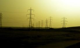
Modern energy services are crucial to human well-being and to a country’s economic development; and yet 1.2 billion people are without access to electricity. It is recognized that the central grid is ...
Modern energy services are crucial to human well-being and to a country’s economic development. Yet 1.2 billion people worldwide live without access to electricity. It is recognized that the central g...
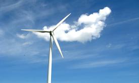
The Global Wind Atlas is a free, web-based application developed to help policymakers, planners, and investors identify high-wind areas for wind power generation. It also serves as a useful tool for g...
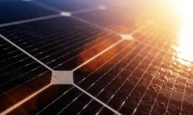
African countries have an evident potential for solar energy. Knowing what amount of solar radiation reaches the earth's surface is of particular interest for solar photovoltaic (PV) installations. It...
In Sub-Saharan Africa, medium- and low-voltage data are often non-existent, uncompleted, or unavailable. This is a challenge for practitioners working on the electricity access agenda, power sector re...
Africa is considered one of the most vulnerable regions to weather and climate variability. Extreme events such as heat waves have important impacts on public health, water supplies, food security, an...
Increasing water scarcity and water quality issues are serious constraints, especially for Northern Africa. A comprehensive assessment of spatial and temporal precipitation frequency is the initial st...
Priority areas are identified using local coefficients estimated through Geographically Weighted Regression (GWR), which measures the spatially varying relationship between access to sanitation and fo...
Priority areas are identified using local coefficients estimated through Geographically Weighted Regression (GWR), which measures the spatially varying relationship between access to electricity and f...
Priority areas are identified using local coefficients estimated through Geographically Weighted Regression (GWR), which measures the spatially varying relationship between access to piped water and f...
This dataset represents a geographic clip to Africa of the
World Database on Protected Areas (WDPA),
which is the authoritative and most complete global dataset on terrestrial and ...
This spatial dataset contains the geographic boundaries and ecological evaluations of 45 Key Landscapes for Conservation and Development (KLCDs) across Sub-Saharan Africa. Building on the K...