African countries have an evident potential for solar energy. Knowing the amount of solar radiation reaching the earth's surface is of particular interest for photovoltaic installations. It can be rep...
Water is essential for life on Earth and a critical natural resource that underpins all social and economic activity. Ensuring water and sanitation for all is one of the Sustainable Development Goals ...
Mangroves are trees or shrubs adapted to saline and brackish environments. They are found in the intertidal zone of tropical and sub-tropical coastlines. Mangrove forests are among the most productive...
At any given place on Earth, complex human-environment interactions are at play. They include differing rates and magnitudes of drivers (e.g. overgrazing, climate change, agricultural practices) and d...
Tropical moist forests have a huge environmental value. They play an important role in biodiversity conservation, terrestrial carbon cycle, hydrological regimes, indigenous population subsistence and ...
Africa is very rich in biodiversity and is the last place on Earth with a significant assemblage of large mammals. This natural richness, accumulated over millions of years, coupled with the wealth of...
Biomes are distinct biological communities (collection of plants and animals) that have formed in response to a shared physical climate. The 11 major terrestrial biomes found in Africa (out of 14 worl...
Biomes are distinct biological communities (collection of plants and animals) that have formed in response to a shared physical climate. They are distinguished by characteristic temperatures and amoun...
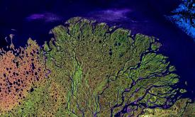
Tensions over freshwater use and management in international river basins are one of the main concerns in political relations. They may exacerbate existing tensions, increase regional instability and ...
Mapping ongoing project activities in the field of conservation in protected areas is essential to identify the various actors and to identify the areas where information and actors are scarce. The ai...
Priority areas are identified using local coefficients estimated through Geographically Weighted Regression (GWR), which measures the spatially varying relationship between access to sanitation and fo...
Priority areas are identified using local coefficients estimated through Geographically Weighted Regression (GWR), which measures the spatially varying relationship between access to electricity and f...
Priority areas are identified using local coefficients estimated through Geographically Weighted Regression (GWR), which measures the spatially varying relationship between access to piped water and f...
This dataset represents a geographic clip to Africa of the
World Database on Protected Areas (WDPA),
which is the authoritative and most complete global dataset on terrestrial and ...
This spatial dataset contains the geographic boundaries and ecological evaluations of 45 Key Landscapes for Conservation and Development (KLCDs) across Sub-Saharan Africa. Building on the K...